![[ Mountain Biking in Henry Coe ]](MountainBikeAtHenryCoe.jpg)
Itinerary 1: Hunting Hollow entrance to Headquarters
Itinerary 2: Blue Ridge
Itinerary 3: Middle Ridge
Itinerary 4: Mississippi lake (1)
Itinerary 5: Mississippi lake loop (2)
Itinerary 6: Mississippi lake loop and the Narrows (3)
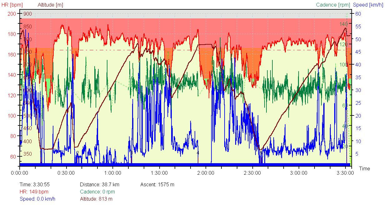
Itinerary 7: Coit lake loop: New Polar Heart Rate Graphs
Itinerary 8: The 3 lakes: Mississippi-Coit-Kelly
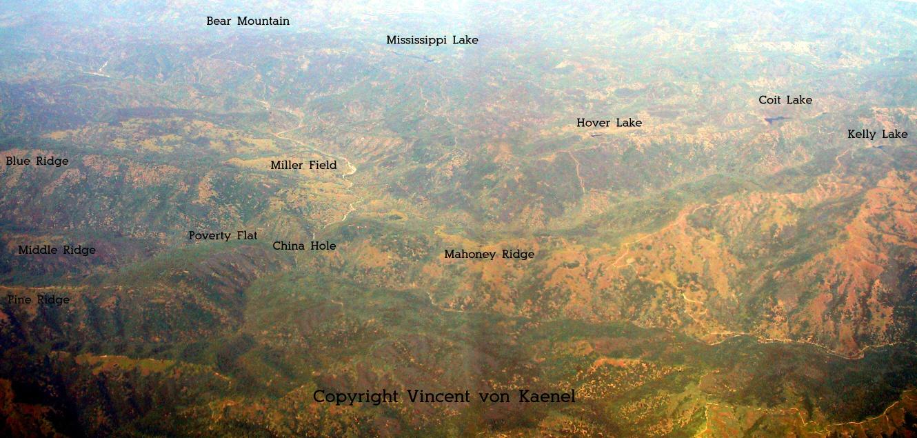
Henry Coe from the air!
Be careful:
1) Riding at Henry Coe can be very difficult.
2) Always register to the Visitor center before your ride.
3) Carry plenty of water and a water filter for long ride.
4) Always carry a pharmacy with you in case of emergency.
5) A very good map of the area is available at the visitor center.
6) Have your bike in perfect mechanical order.
7) The riding times given below are just riding time. They do not include idle time!
8) The riding time information is obviously depending on your physical condition, and on the trail conditions.
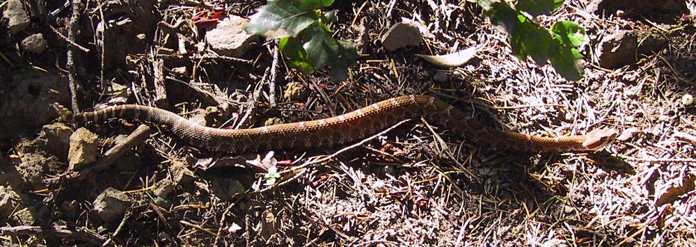
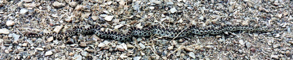
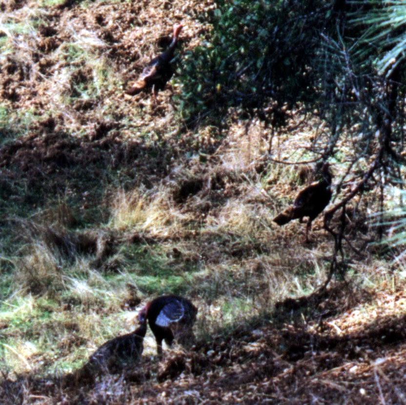
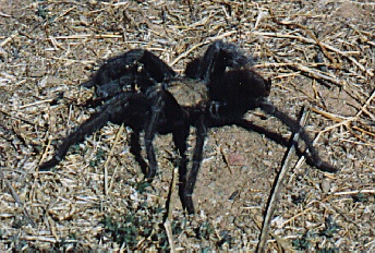
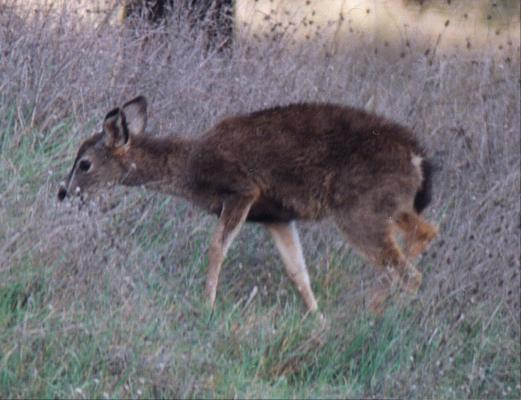
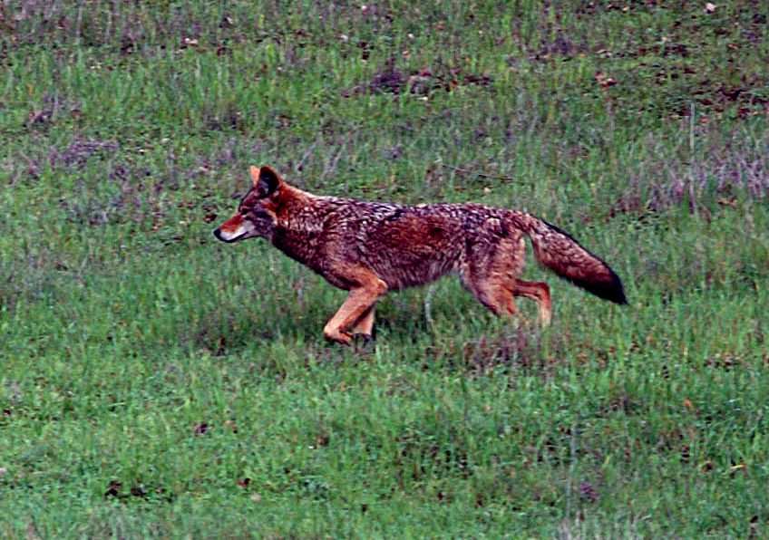
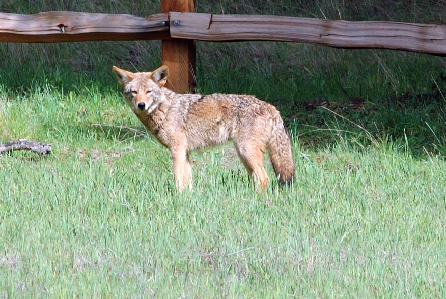
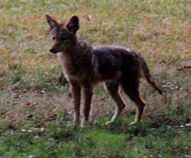
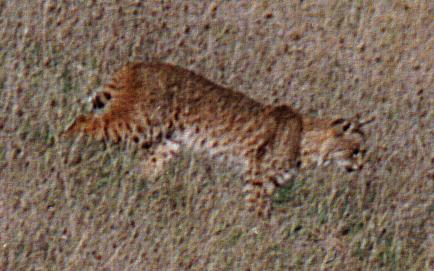
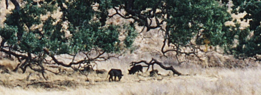
9) Expect a lot of wild life: rattlesnake, snake, wild turkey, tarantula, deers, coyote, coyote, coyote , another coyote, bobcat and wild pigs.
Riding at Henry Coe is a unique experience!
If you have any questions or any comments about these rides, please send me an email.
Itinerary 1: Hunting Hollow entrance to Headquarters
Distance/Elevation: 11 miles/3700 feet (17.6km/1130m)
Riding time: 2hours
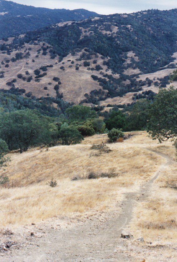
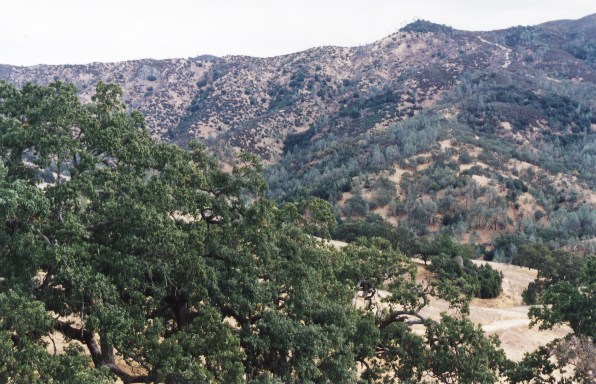
This ride is mainly on fire roads except for the variant through China Hole (not on my map). The ride last approximately 2 hours for 11 miles and 3700 feet elevation.
The ride is shown on the map.
Start at the Hunting Hollow Entrance and go on the Coit Road. Make a left on Mahoney Meadows Road. There are 2 variants from there:
a) Make a left on China Hole Trail, cross the creek and go up China Hole Trail to reach the Manzanita Road and then the Headquarters. This is the preferred way.
b) Continue on Mahoney Meadows Road until you reach Los Cruzeros and take Poverty Flat Road to the Manzanita Road. The climb after Poverty Flat is not fun.
This is a very nice trail, crossing the park from south to north.
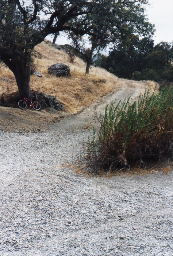
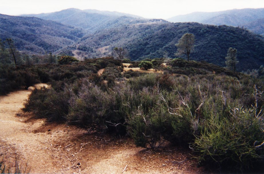
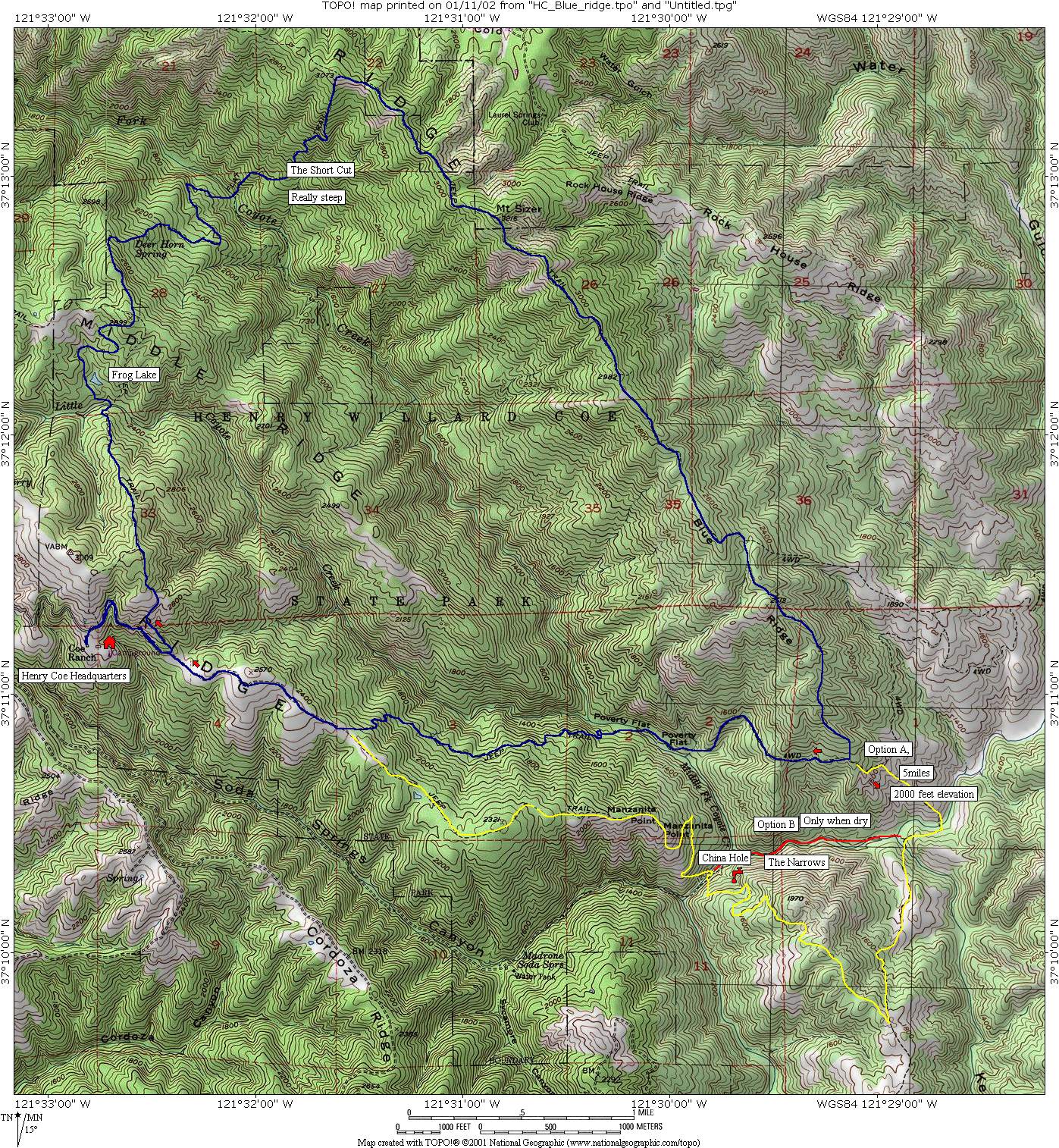
Itinerary 2: Blue Ridge
Distance/Elevation: 14 miles/4600 feet (22.4km/1400m)
Riding time: 2h30
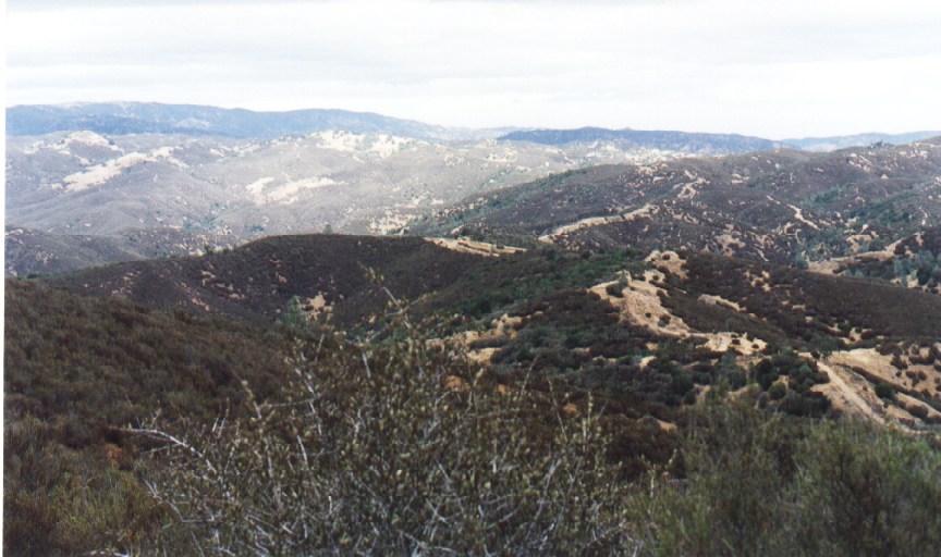
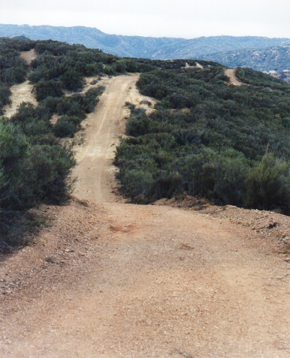
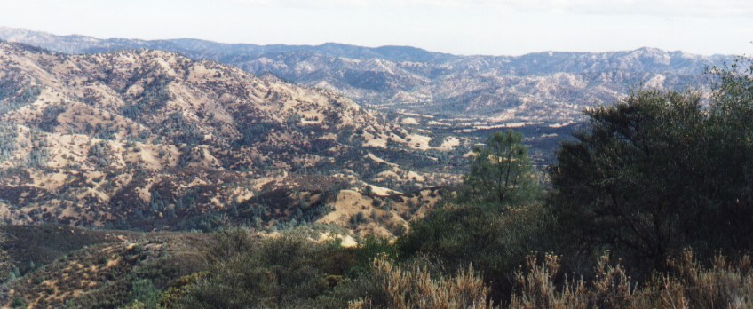
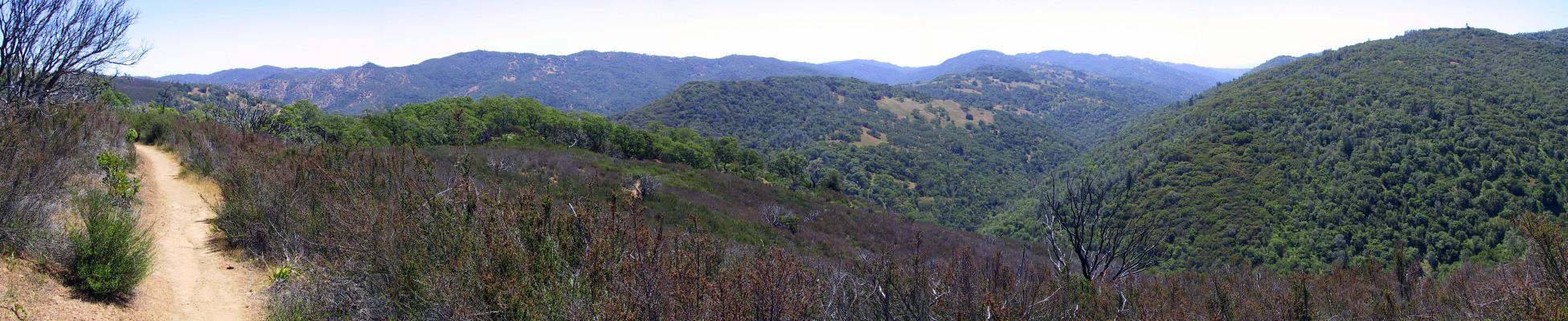
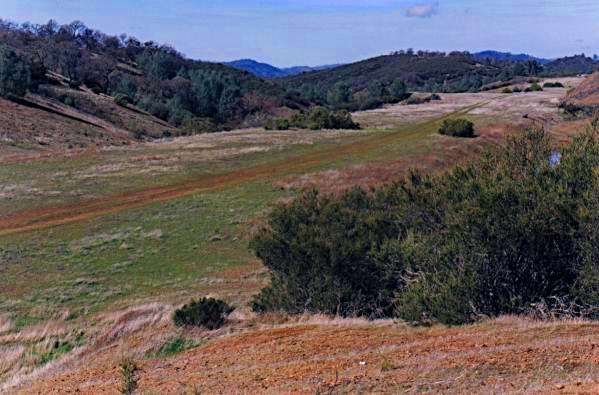
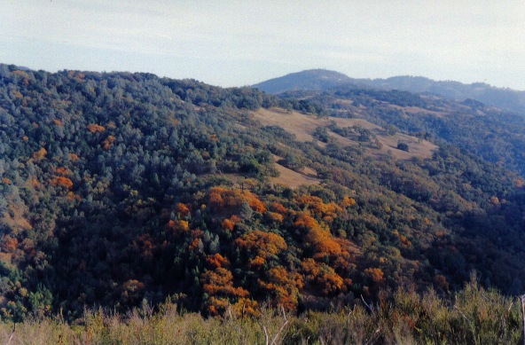
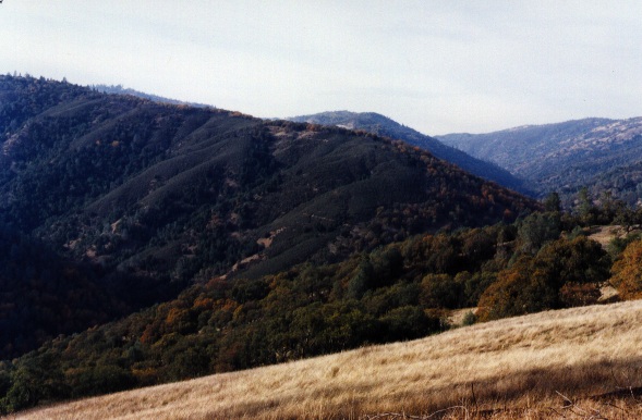
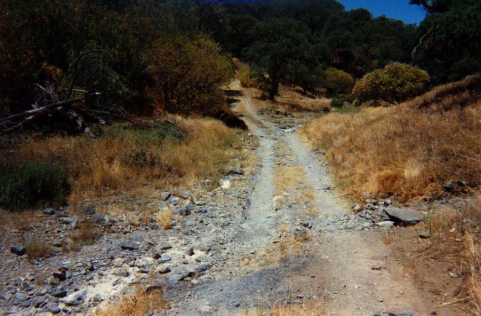
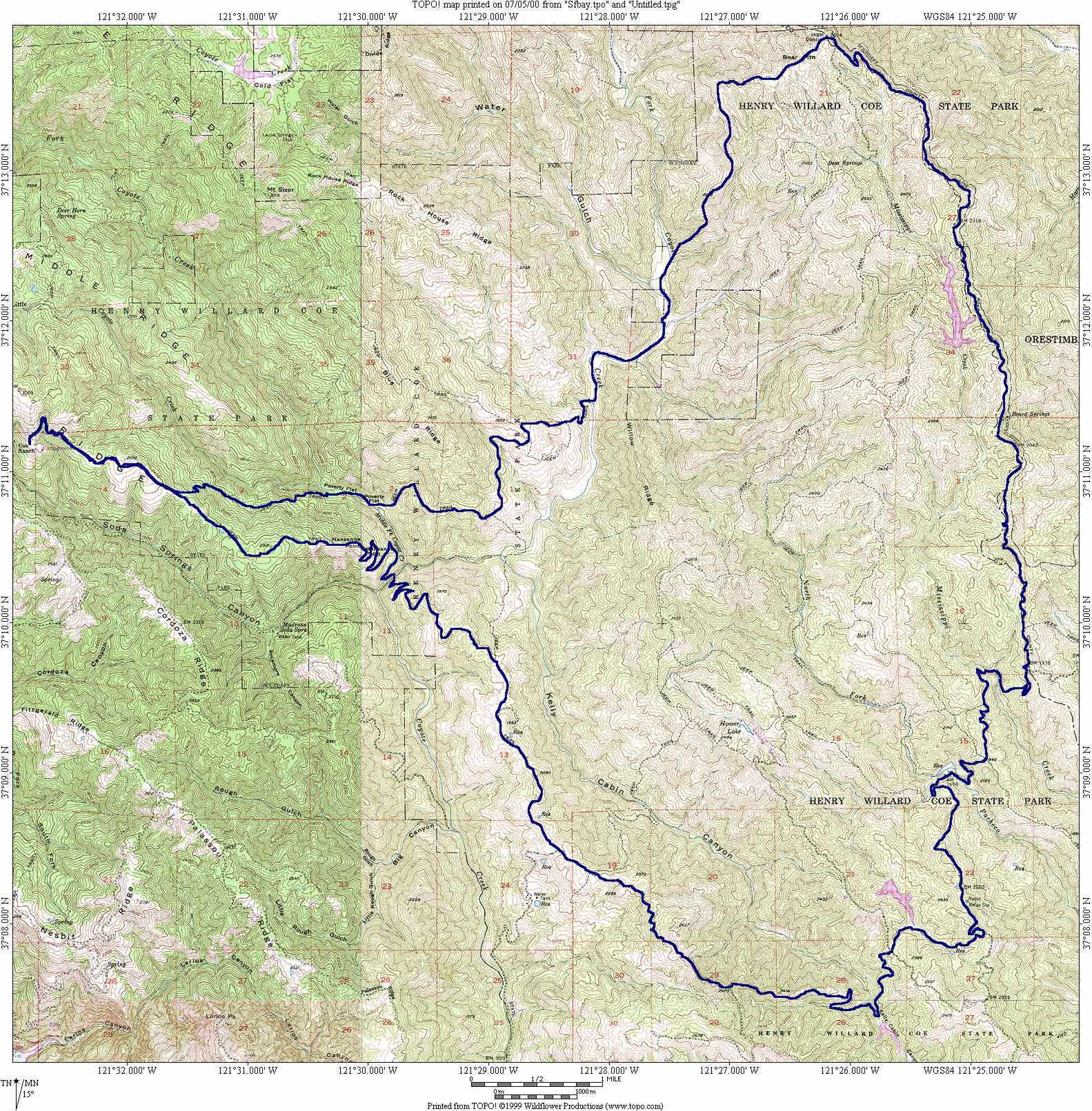
This is a classical ride in Henry Coe. The ride is mainly on fire roads except for the variant by Jackass trail which is a short cut from the blue ridge road to the poverty flat road. The ride lasts approximately 2h30 for 14 miles and 4600 feet elevation. From Headquarters to Middle Ridge it takes approximately 25 minutes. The view on the "Short Cut" (named HOBBS Road on the map) show that this section is very steep. Crossing the Middle Fork Coyote Creek could be problematic in the winter. Then to reach the top of the short cut road the total time is close to 1h. It is almost not possible to ride up the short cut road. From the top of the Blue Ridge the view is very nice. The itinerary follows the Blue Ridge top road, passing the Mt. Sizer (3216 feet). The trail continue then on the Jackass Trail. An alternative way is to continue on the Blue Ridge Road until the crossing with Poverty Flat Road and the follow the direction of Poverty Flat. Another river crossing at poverty Flat. The way up on Poverty Flat road is not easy even if it is on a fire road.
The map is available here and here it is shaded. The profile of the ride is here. The TOPO map file can be downloaded here. Take plenty of water in the summer time.
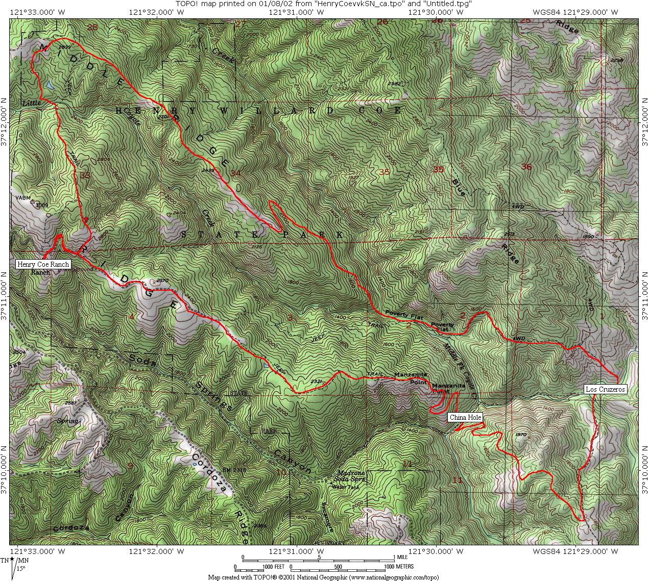
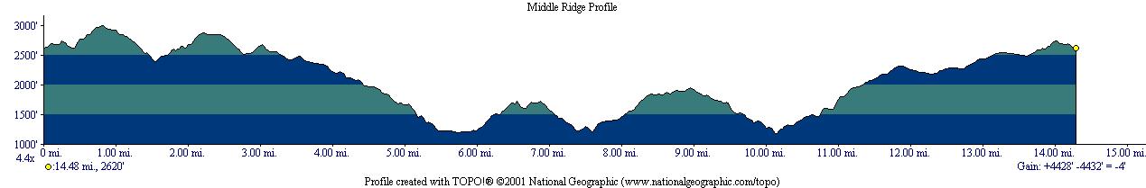
Itinerary 3: Middle Ridge
Distance/Elevation: 8.5 miles/3000 feet (13.6km/910m)Riding time: 1h45
Middle Ridge is a very popular ride in Henry Coe. It is relatively short (8.5 miles) the the elevation is moderate (3000 feet). The ride lasts approximately 1h45'. The map is here and the profile is here.
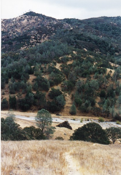
Start from the Coe Headquarters on the Manzanita Road, make a left on Hobbs Road. The beginning of Hobbs road is very steep. After passing Frog Lake make a right on Middle Ridge Trail. Go down this single track. The downhill section is steep and technical on a single track. At Poverty Flat, climb the Poverty Flat road to reach the Manzanita Road and then back to the Headquarters.
Itinerary 3bis: Middle Ridge and China Hole
Distance/Elevation: 14.5miles/4400 feet (23.3km/1350m)Riding time: 2h45-3h
This ride is longer than the previous one (3, just above). It has a lot of single track trail either up or down hill. The ride lasts approximately 2h45'. The map is here and the profile is here.
Start from the Coe Headquarters on the Manzanita Road, make a left on Hobbs Road. The beginning of Hobbs road is very steep. After passing Frog Lake make a right on Middle Ridge Trail. Go down this single track. The downhill section is steep and technical on a single track. At Poverty Flat, climb the Poverty Flat road to reach the Jackass pass and then go down to Los Cruzeros. Then climb to the top of Mahoney Meadows Ridge using the single track Lost Spring trail. From the top go down the China Hole trail to China Hole. From there, climb the China Hole trail in direction of Manzanita Point and then to the Headquarters.
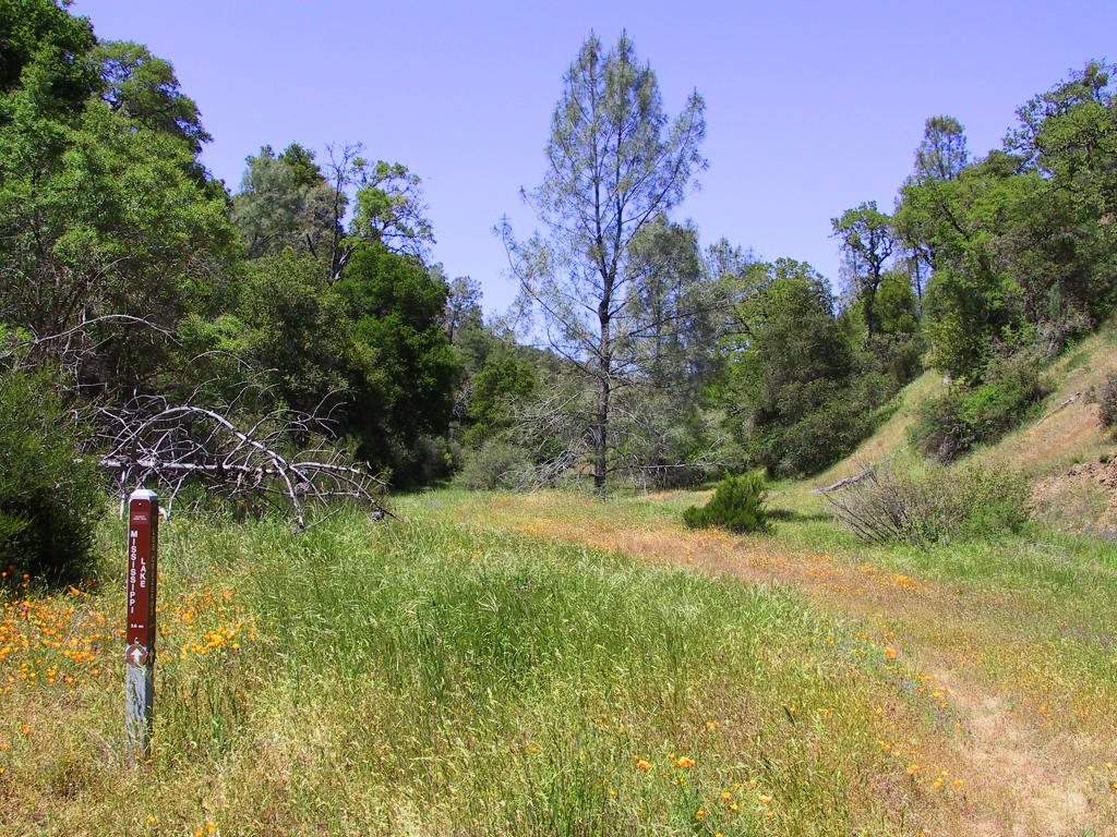
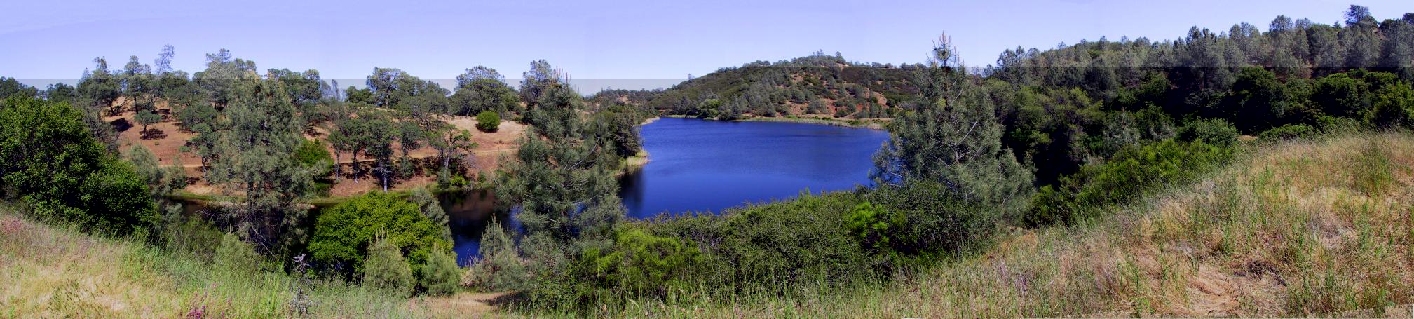
Itinerary 4: Mississippi lake (1)
Distance/Elevation: 22 miles/6600 feet (35km/2010m)
Riding time: 4 hours
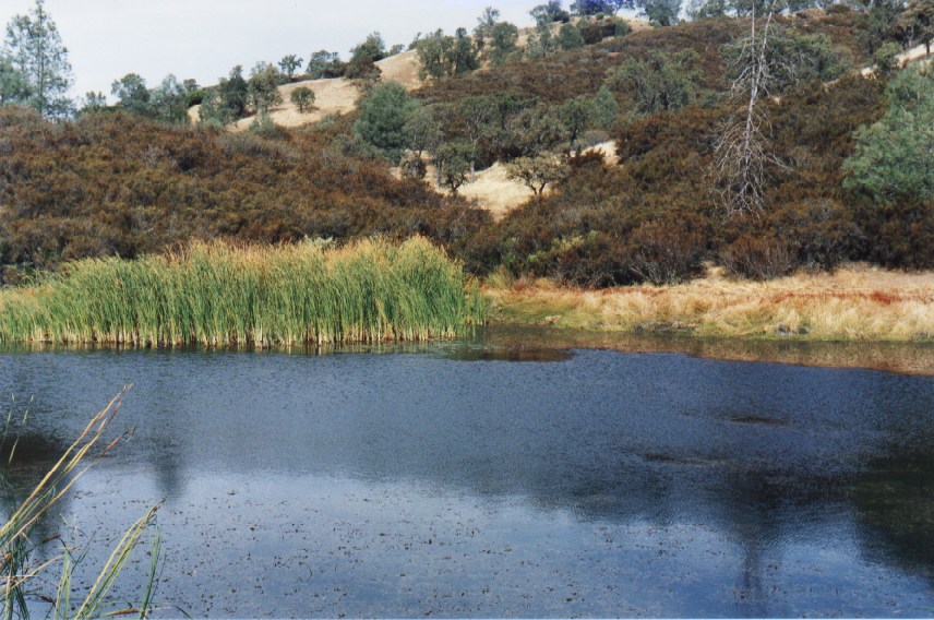
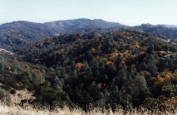
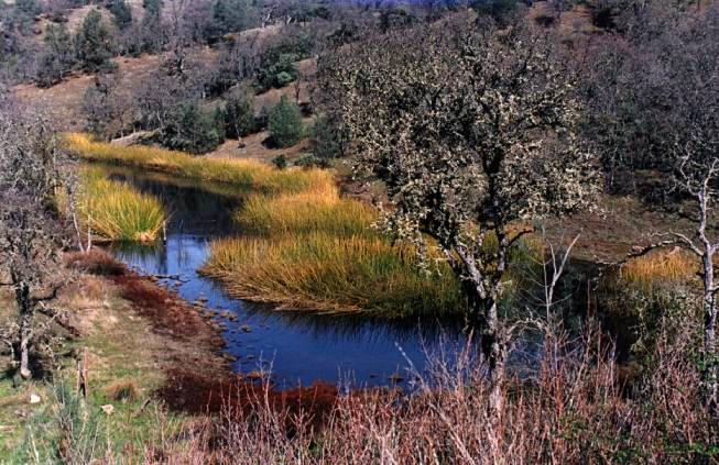
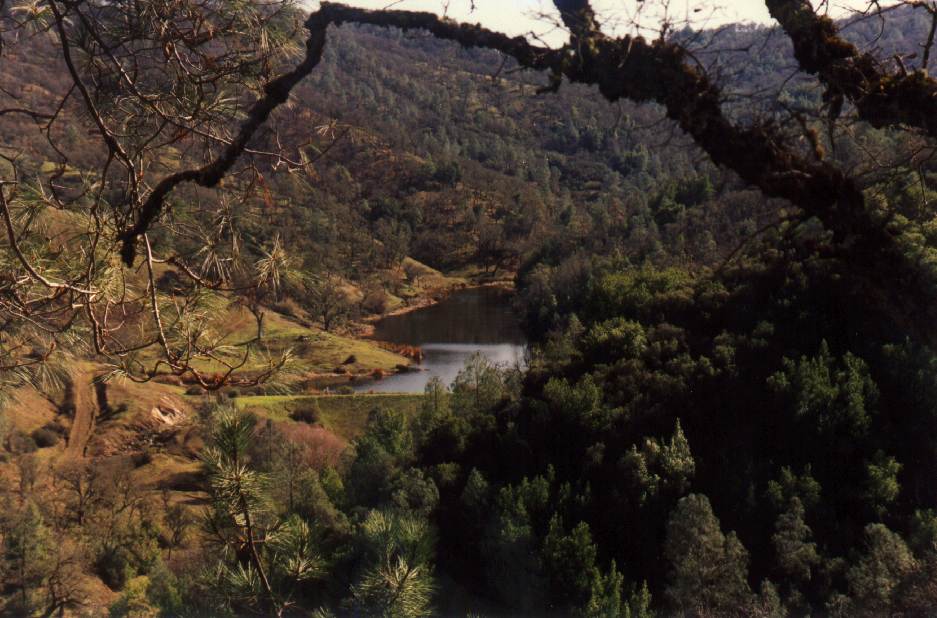
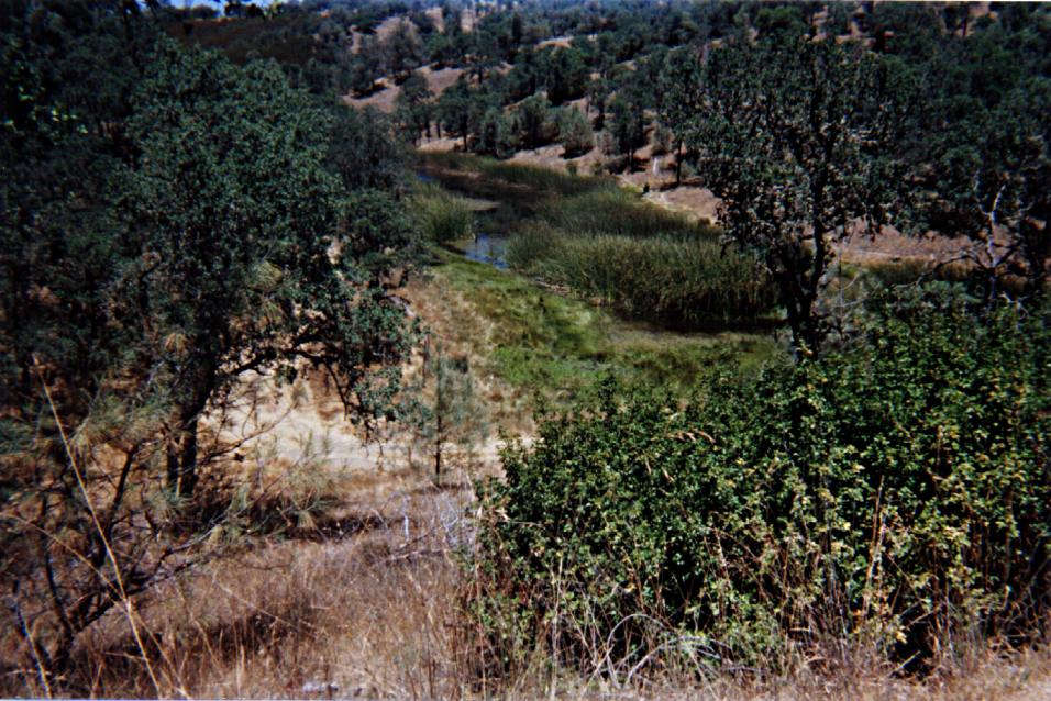
This long ride is mainly on fire roads. The ride lasts approximately 4h of riding (does not include time for halts) for 22 miles and 6600 feet elevation. The ride goes deep into the wild part of Henry Coe and is beautiful. The willow ridge trail is very steep. The Roller Coaster Ridge is very nice to ride, a lot of funny ups and downs. It is possible to see some turtle close to Mississippi lake.
The map is here and the profile is here.
Start from the Headquarters on Manzanita Road in direction of Poverty Flat. Use Poverty Flat road to Los Cruzeros. Then climb the Willow Ridge Trail. Make a left on Willow Ridge Road (Roller Coaster Ridge). You can turn around the lake and go back to Coe Headquarters by the same way.
Itinerary 5: Mississippi lake loop (2)
Distance/Elevation: 23 miles/6000 feet (37km/1830m)
Riding time: 3h45
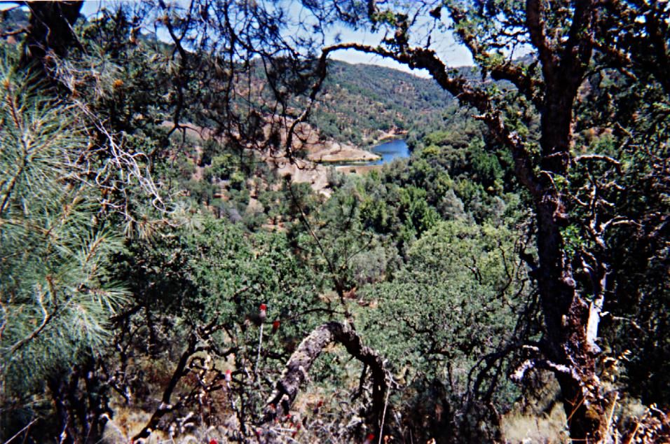
An other long ride to reach Mississippi Lake is described here. Starting from the Coe Headquarters, head to Poverty flat and then up the Jackass Peak, pass Mahoney Meadows Road to make a right down to Schaffer Corral Trail. During the wet season it might be better to continue on the Poverty flat road and make a right down into Blue Ridge Road because the Schaffer trail is mainly in the river bed! Then take the Bear Mountain Road (Bear Mountain Road during spring) all the way up to the top of Bear Mountain. The view on the Orestimba Wilderness is beautiful. Just after the summit leave the main road and make a right into an old road that will end on the west part of Mississippi Lake. To get there from Coe Headquarters takes approximately 1h45min.
The trail continues on the Roller Coaster Road with a lot of ups and downs (Roller Coaster Road during spring time) until you cross the Willow Ridge Trail on your right. Go down Willow Ridge single track to Los Cruzeros (Los Cruzeros during spring). Then take Poverty flat Road up to the Headquarters. One interesting option is to climb China Hole instead the Poverty flat Road. To use this alternative way up you have to make a left as soon as you reach the flat section of the road at Poverty flat and then follow the rocky trail (not easy to ride...) up to China Hole. Then climb the China Hole trail and then use Manzanita Road to reach the Headquarters.
The whole loop (map) takes approximately 3h45min for 23 miles and 6000 feet of elevation.
Pictures were taken on November 7th 1999 and April 22nd 2000.
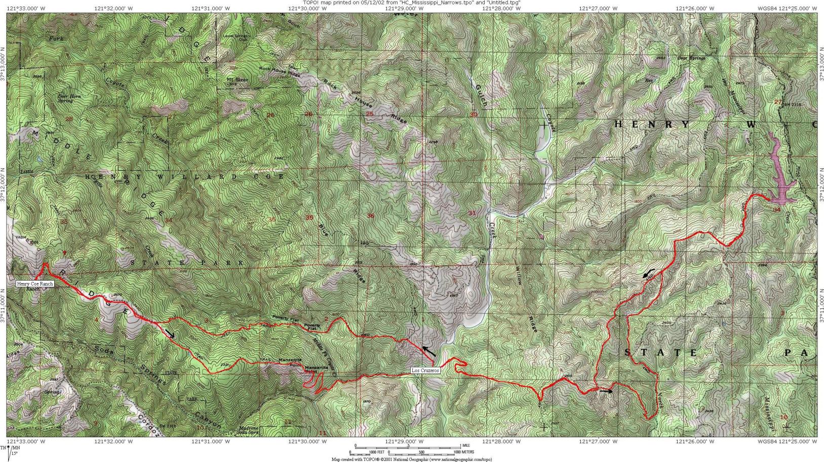
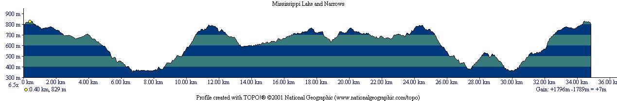
Itinerary 6: Mississippi lake loop and the Narrows(3)
Distance/Elevation: 25 miles/5900 feet (40km/1800m)
Riding time: 4h30-5h
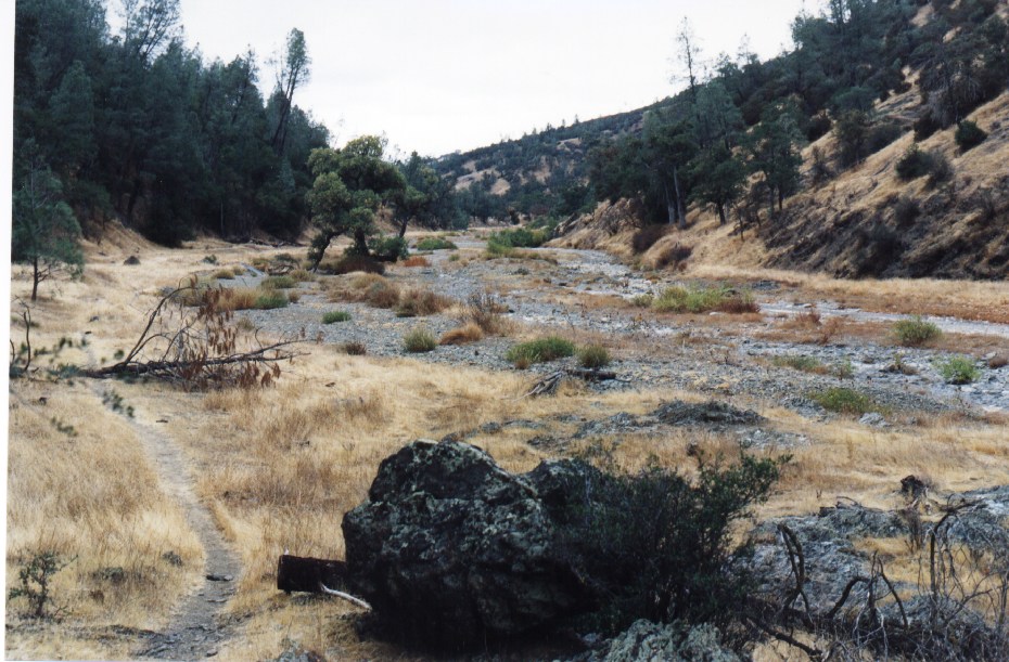
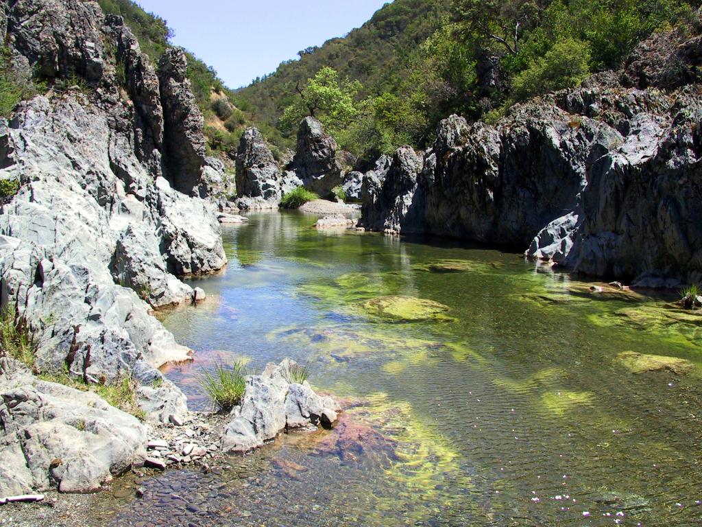
If you would like to visit the Narrows, this might be a ride for you. However, you should check at the visitor center that the water level is low enough in the Narrows to safely go through this section of the ride. In the winter and early spring the water level is too high to allow this ride. From the Coe Headquarters, head to Manzanita Point and then go downhill on China Hole Trail to reach China Hole. Then heads into the Narrows, following the trail. Be careful in this section during the spring time. There is a lot of rattlesnakes and other snakes swimming in the river. You have to carry your bike most of the way to Los Cruzeros. Go up the Willow Ridge Trail and make a left on the top. Go down Rat Spring Trail to Pacheco Creek Trail and follow the single track trail to the Willow Ridge Trail (path is not always clearly marked, use an accurate map). You will reach Mississippi Lake on this road. The way back to the Headquarters uses the Willow Ridge Road, goes down the Willow Ridge Trail, crosses the East Fork Coyote Creek at Los Cruzeros, goes up the Poverty Flat Road and down to Poverty Flat. From there it is all uphill to the Headquarters using the Poverty Flat Road and then the Manzanita Point Road to the Visitor Center. The map and the profile are available here. The pictures were taken on May 11th 2002.
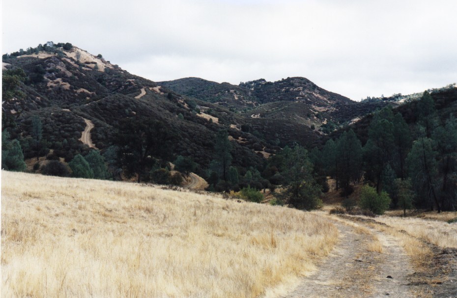
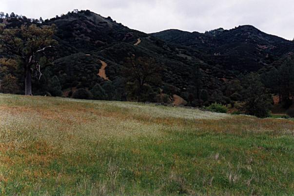
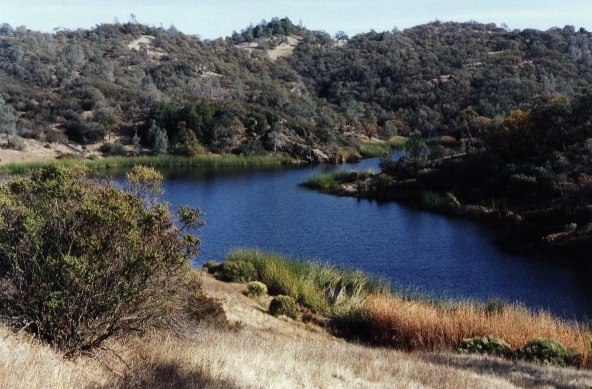
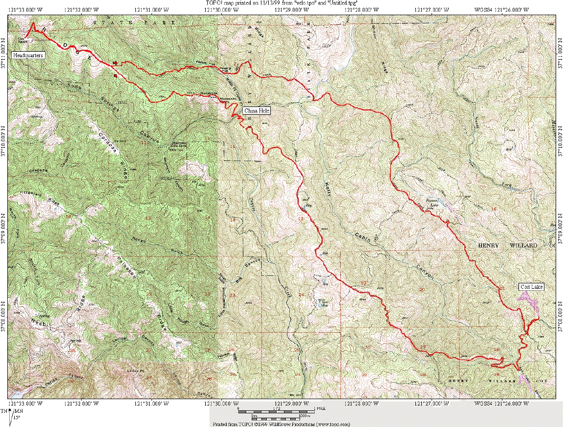
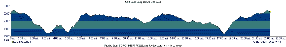
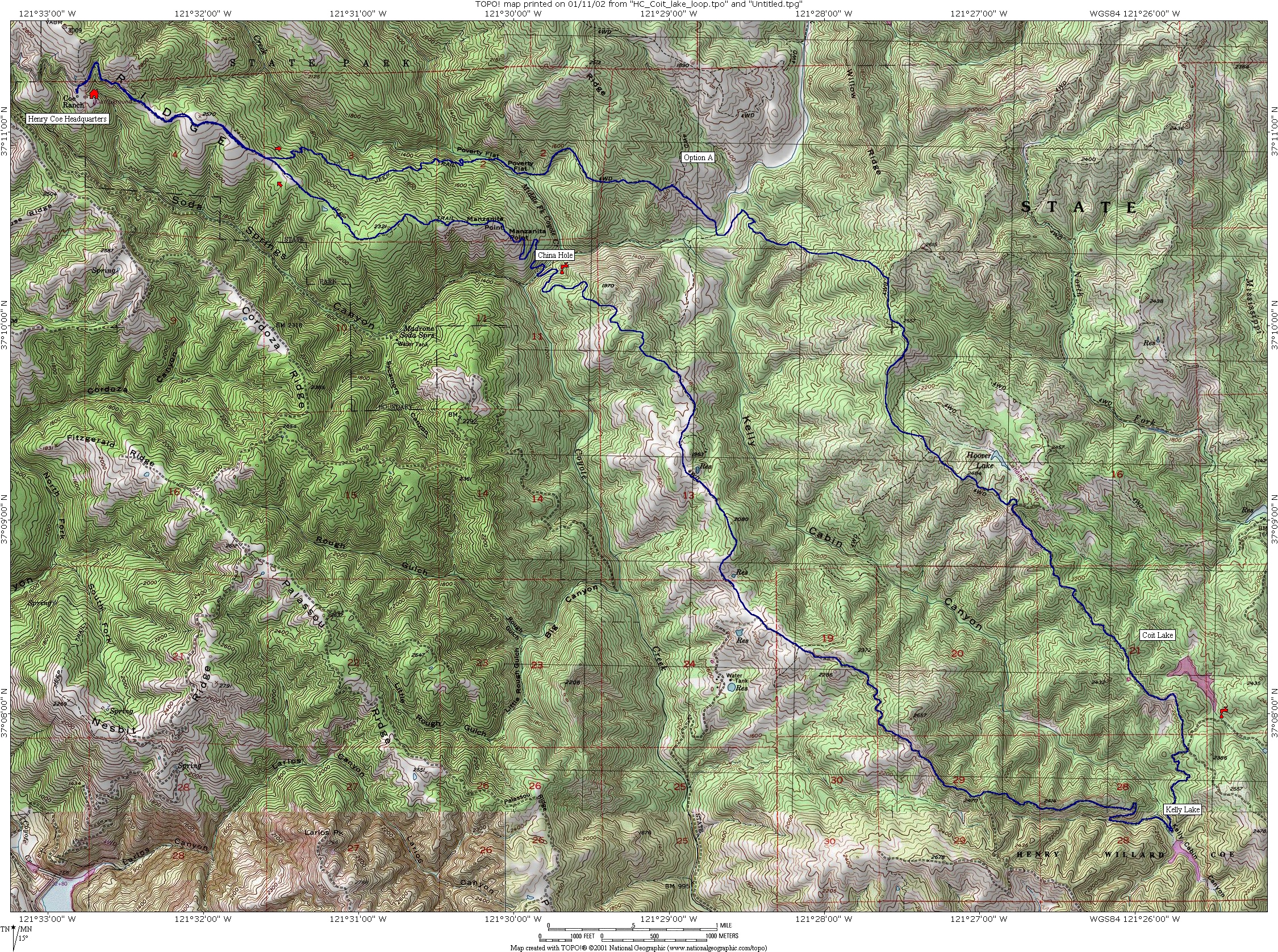
Itinerary 7: Coit lake loop
Distance/Elevation: 24 miles/5300 feet (38km/1600m)
Riding time: 3h-3h15
This loop is easier than the Mississippi lake loop. The ride starts from the Coe Headquarters and make a loop through Coit lake, Kelly Lake and China Hole. It lasts approximately 3h-3h15' for 22 miles and 5600 feet of elevation. Here is the map and the profile of this loop. Here is a bigger shaded map (3MB) of this loop.
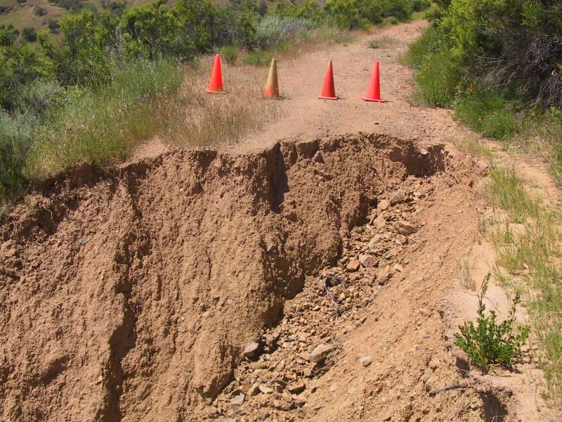
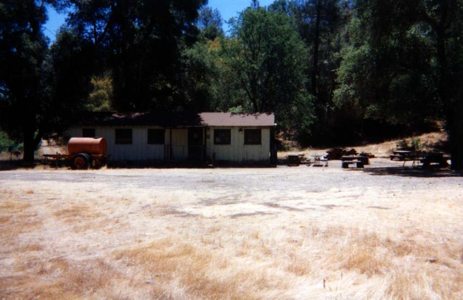
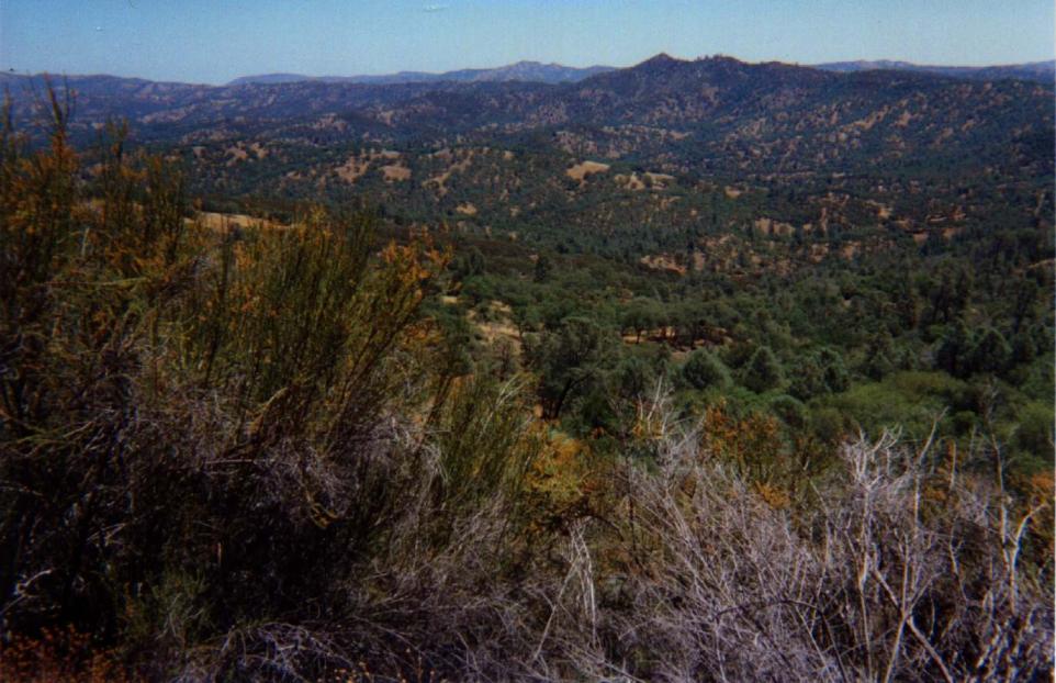
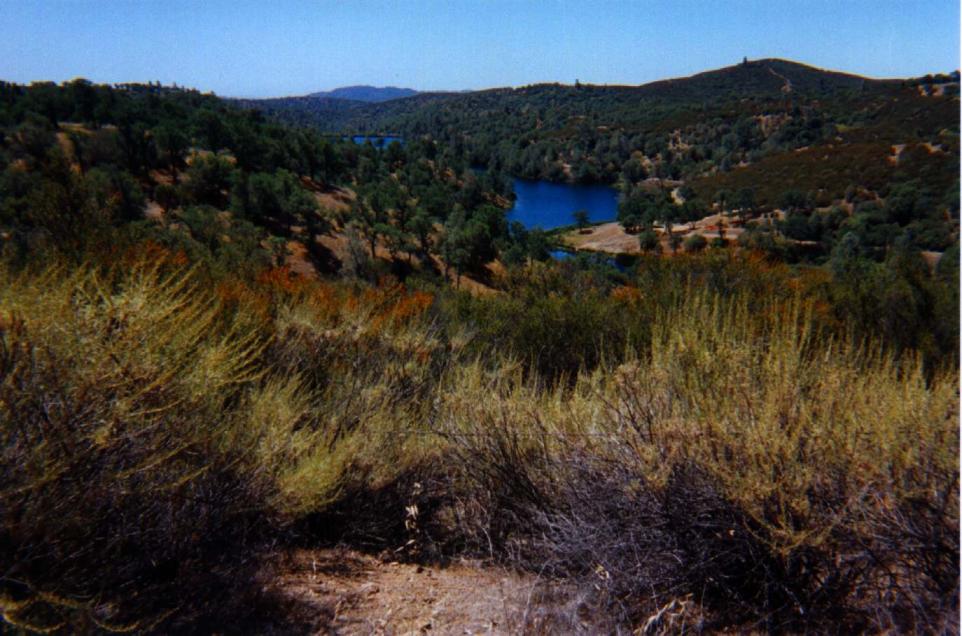
From the Coe Headquarters head down to Poverty Flat and then up the Jackass Peak and continue to Los Cruzeros. Then climb the Willow Ridge Trail. Make a right on the Willow Ridge Road (about an hour from HQ). On your left you may see the old landing strip and then the first view of the Coit lake. You can access the lake by the north or the south. Continue the loop (on Coit Road) in the direction of Kelly lake and then Mahoney Meadows Road. Coit Road has been washed out during the winter 2005 close to the Wasno Road, be prudent!. Then take the China Hole single track trail (about 2 hours from HQ) down to China Hole. Climb the nice China Hole trail up to Manzanita point. From there take the Manzanita Road to reach the Headquarters. You can download the TOPO map file here.
The total time for this loop, including pauses, is close to 3h30'. The Polar Heart Rate graphs are accessible here (January 19th 2002). They contain Heart Rate, altitude, pedaling cadence and speed recorded during the loop every 5 seconds.
Pictures were taken on December 5th 1999, on February 6th 2000 and on April 2nd 2001 and April 30 2005.
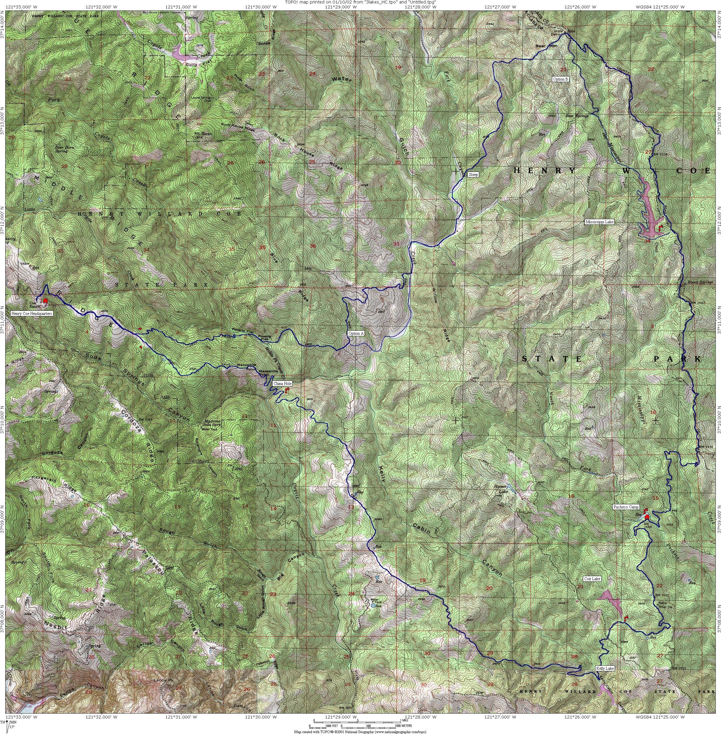
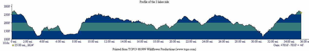
Itinerary 8: The 3 lakes: Mississippi-Coit-Kelly
Distance/Elevation: 36 miles/7800 feet (58km/2400m)
Riding time: 5h
This is a really long ride, be prepared and trained!
The ride starts at Henry Coe headquarters. Go down to Poverty Flat on Poverty Flat Road, follow this road to the Blue Ridge Road and then go down to reach the Bear Mountain Road. It takes about 1 hour to reach the bottom of the Bear Mountain climb. Go up the Bear Mountain and then take a right on the County Line road. Pass the Mississippi lake (about 1h50 from HQ). Continue on this road and then make a left on Coit Road. Cross the Mississippi creek, go up the hill and reach Pacheco Camp (about 2h30 from HQ). Pass Coit lake (about 3h from HQ) and then Kelly lake on Coit Road. Continue on Mahoney Meadows Road and make a left on China Hole Trail. Go down this single track, pass China Hole (about 4h from HQ) and then climb the China Hole Trail to Manzanita Point Road. Continue to the Headquarters.
The ride last approximately 4h50 to 5h10 for 36 miles (58km) and 7800 feet (2400m) of elevation. The overall time for this loop was 6h to 6h30. Here is the map, a big map (2.5MB), the TOPO map file, and the profile of this loop.
Pictures were taken on July 4th 2000 and on April 29th 2001.
For more information :
- Henry W. Coe State Park official web site.
- Wikipedia on Henry Coe State Park
- Biking.com - the complete biking resource
- Lee Dittmann Web site on Henry Coe has a lot of well presented informations on the park